| Explanation of the distribution tables |
|
The use of colourThe tables with distribution data try to indicate the chance to notice a particular bird in the different regions of Suriname. Of course this chance does depend on the experience of the birder, assumingly a trained observer with knowledge of birdsongs.The colors used have the following meaning:
The different areas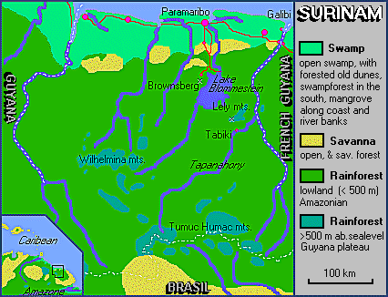
A selfmade map of Suriname should accompany this page to indicate the the position of the different areas: I did not find the time yet to make one. But a simple map from the (former) pages of Marco Bleeker will do (with permission and still his copyright). The partitioning of Suriname in five areas is rather coarse. The main reason is that the number of observations is so low. Apart from easily reachable places, a lot of points on the map have only once been visited by a bird-watcher and outside those spots nobody has reported. Mountain forests means forests on places higher than 400 m. Most observations come from Brownsberg nature reserve. For the Sipalawini region especially there have been only a few visitors and so not many bird observations. The main contributors of bird observations are mentioned in a list. In my database there are over 150.000 observations of one or more birds of a species in a place at a specific date. Distribution maps for Suriname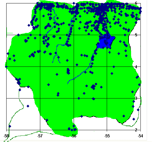
As already stated above, the number of places visited by birders and reported to me is only about 500. Also the distribution of these places over Suriname is rather uneven. The map at right shows all places with at least one report. The forest especially is not often visited apart from the Raleigh Falls-Voltzberg nature reserve. In West and South Suriname areas can be found with no visited place within 50 kilometer. Of course it is difficult to get there. Still the number of species reported for the southern part (below 5 degrees North) is greater than for the part above that line. Distribution maps for South AmericaFor some birds there are maps of the distribution in South America. They are only meant to globally indicate the areas where a bird can be found. They were produced from the general literature as cited on the "books" page. |